
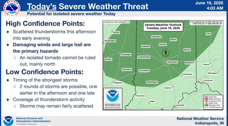
Severe weather threat remains possible today, likely Wednesday
Parts of our area are under a risk of severe weather again today and Wednesday, according to emergency officials.
The National Weather Service says there is a marginal risk of severe weather today north of a line roughly from Bloomington to Greensburg, including parts of Bartholomew, Brown, Johnson, Shelby and Decatur counties. We can expect scattered thunderstorms, some of which could turn severe with the possibility of damaging winds and large hail. A marginal risk is the lowest risk level tracked by forecasters.
Wednesday brings a greater risk of severe weather with an enhanced risk again north of the Bloomington -Greensburg line and a slight risk to the south. The storm system is expected Wednesday afternoon into the evening with multiple rounds of storms possible. Destructive winds, large hail, tornadoes and flash flooding are all possible. An enhanced risk is the third highest risk level tracked by the National Weather Service.
Emergency officials urge you to be prepared to take action if necessary. They say that you should have multiple ways available to track severe weather conditions and a plan in place should you need to find shelter at home or at work.
