
Forecasters: Seymour tornado was weak, rare landspout
Last night’s tornado warnings in Jackson, Bartholomew and Jennings counties were the result of the sighting of a relatively rare landspout tornado, rather than a traditional twister, according to the National Weather Service.
Tornado warnings were issued at about 6:30 p.m., after a confirmed funnel cloud briefly was seen northeast of Seymour, moving north at 40 mph, with warnings that the tornado would be near Columbus by 6:45 p.m. But before the funnel reached Columbus, the storm had weakened and the weather service said it no longer was strong enough to support a tornado.
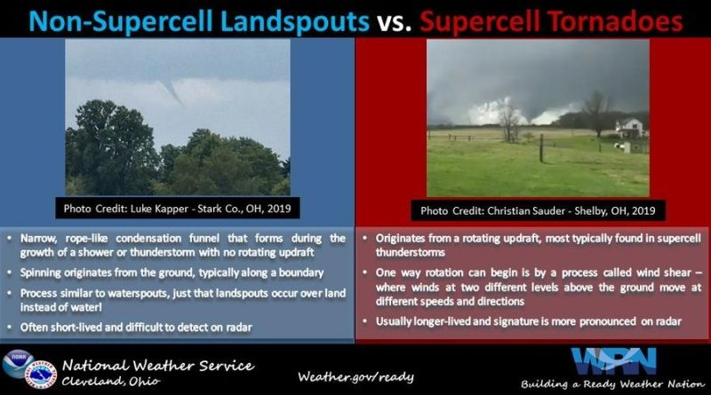
The weather service said that a normal tornado forms from wind shear in the clouds of supercell thunderstorms causing rotation and that rotation descends to the ground. However, a landspout starts from surface level wind shifts, which can get sucked up into a non-rotating thunderstorm, stretching the vortex vertically up to the cloud level.
Landspouts are difficult to see on radar, because of the lack of storm rotation.
Graphic courtesy of National Weather Service.