Saturday’s severe weather included three area tornados
Saturday’s winds that knocked down trees, damaged buildings and took out power for tens of thousands of residents included three separate tornados in our area, according to the National Weather Service in Indianapolis. The weather service says the damage was caused by a combination of straight-line winds and rain-shrouded tornados.
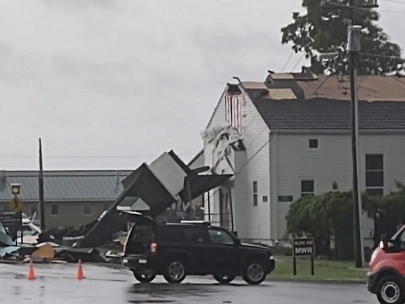
The three tornados included touchdowns in Brown, Johnson and Shelby counties, including a hit at Camp Atterbury that ripped the steeple off of the base chapel.
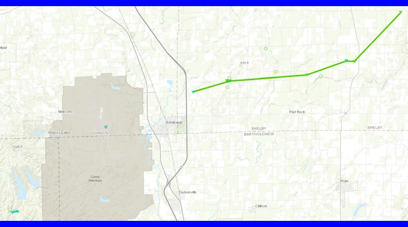
The longest of the three was a 14-mile tornado that started north east of Edinburgh at 3:47 p.m. Saturday, skipping across almost 14 miles of southern Shelby County with wind speeds of up to 110 mph. At its widest, the tornado reached 100 yards across near Mount Auburn and has been classified as an EF-1. It ended at 4:12 p.m.
The Johnson County tornado touched down at Camp Atterbury with 84 mph winds at 3:48 p.m. In addition to the chapel damage, the tornado also lifted some cars after plywood from the chapel was blown under their wheels. It was an EF-0.
In Brown County, another EF-0 tornado touched down at 3:40 p.m. near Princes Lakes with 84 mph winds.
Each of the tornados were also accompanied by 80-90 mph straight line winds in a wider area.
Photo courtesy of Indiana National Guard. Map courtesy of National Weather Service.