
Strong thunderstorms, high winds in today’s forecast
Emergency officials say that we are under an enhanced risk of severe weather today with thunderstorms and strong winds possible.
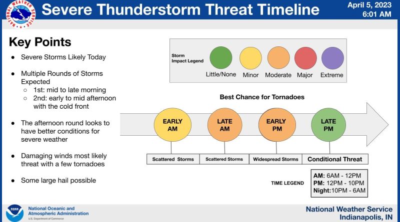
Our area and most of Indiana is now under an enhanced risk of severe weather. The storms are expected to hit in multiple waves with the greatest chance of severe weather from late morning to early afternoon. Storms are expected to move across the Ohio River and out of our area by this evening.
The main threats are damaging winds, large hail, and possible tornadoes. A wind advisory is in effect from 8 to 8 today with 60 mph wind gusts possible.
Bartholomew County Emergency Management recommends that you ensure you have multiple ways to receive weather alerts. Tornado sirens are meant to be heard outdoors and you shouldn’t rely on them to alert you if you are inside. You should check to make sure you have fresh batteries in flashlights and your weather radio. And make sure to fully charge your cell phone.