
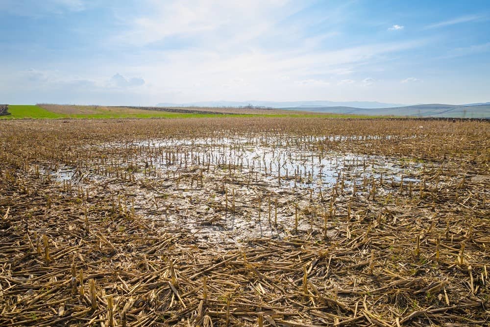
Planting Weather Forecast: More Moisture Will Continue to Slow Progress
Way too much moisture in the planting forecast this time around. We only see a couple of days that stay precipitation free, and they are not really next to each other.
Saturday turns out rain free, but we see plenty of clouds holding on through the day in the wake of the rains that came through Friday and Friday evening. So, while we are not adding more moisture, we likely will see limited evaporation through the day and a lid stays on temps. Scattered showers are back in the state Saturday overnight through Sunday midday with rain totals of up to half an inch.
Sunday afternoon clouds will give way to some late sun, and then Monday we stay mostly dry as the active precipitation track sets up to our south, along and south of the Ohio River Valley. This dry look is short lived, though. Clouds build overnight Monday night.
We are very unsettled then Tuesday through Saturday. We have a chance of scattered showers and storms every day with about 60% coverage. All of us have the potential for multiple rounds of rain from Tuesday through the end of the 10 day forecast window. A few thunderstorms can be strong. Temps stay warm, fueling the convection. The week looks rather soggy, with combined rain totals for the Tuesday to Saturday period at 1”-3” at least, and coverage at 100%. The map below shows rain totals for the full 10 day window, through next Sunday evening.
Extended Period:
Two systems in the extended 11-16 day forecast window. We start the period dry Monday and Tuesday but then see Rain showers develop with a system for Wednesday the 15th. That round produces .25”-.75” with coverage at 80%. After a dry Thursday period, another stronger system arrives for Friday the 17th with .25”-1” rains and coverage at 100%. We should finish the period dry from Saturday the 18th through Monday the 20th.
Weeks 3 & 4:
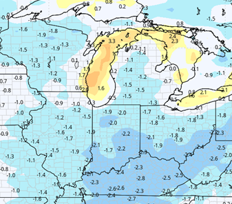
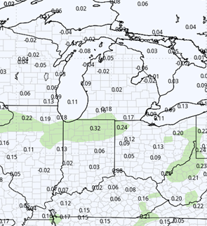
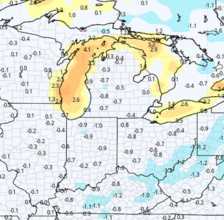
Not a lot of good news in the far extended window either this time around. Precipitation will stay close to normal for the entire week 3 and week 4 outlook. Meanwhile, week 3 looks cool, meaning any potential drying will be slowed, and we bounce back only to “near normal” for week 4. The forecast is a bit concerning.
Week 3 Precipitation (Green = above normal, Brown = below)
Week 3 Temperatures (yellow/orange = above normal, blue = below)
Week 4 Precipitation (Green = above normal, Brown = below)
Week 4 Temperatures (yellow/orange = above normal, blue = below)
“}]]