
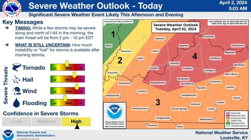
Forecasters warn severe weather likely today
Forecasters say parts of our area fall under an enhanced or even moderate risk of severe weather today.
The National Weather Service says severe storms are possible and those could include large hail, damaging winds and tornadoes. A severe weather event is likely this afternoon and evening, with the biggest threat from 2 to 10 p.m.
A moderate risk assessment is the second highest level of risk issued by the agency and that area includes southeastern Indiana in a line stretching roughly from Corydon through North Vernon. The rest of our area falls under the lower enhanced risk assessment.
A flood watch remains in effect for our area through this afternoon. Forecasters say that excessive rainfall continues in our area and runoff could result in the floodign of rivers, creeks, streams and other low-lying and flood prone locations. Flash flooding is possible.
The flood watch is in effect until 2 p.m. this afternoon.